File:WRF Sectors.png
From Agrineer.org Wiki
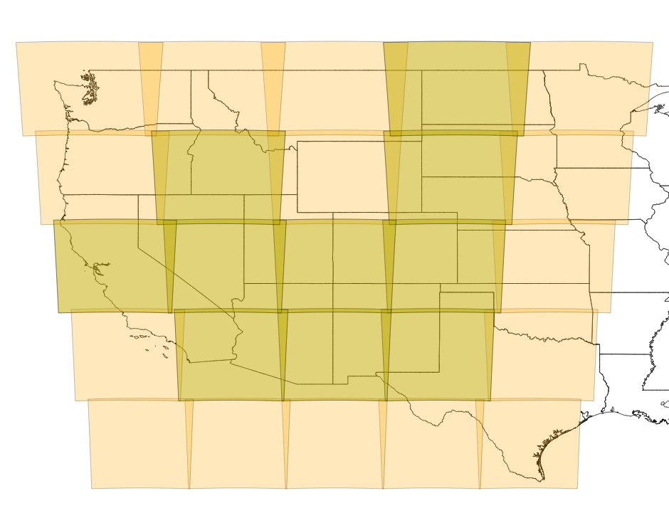
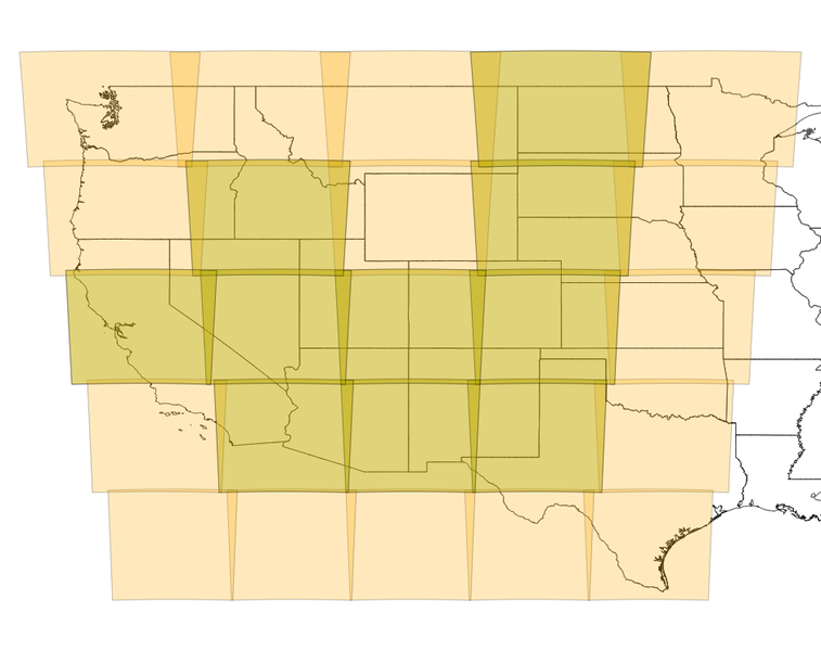
Revision as of 19:21, 3 March 2017 by Agrineer (Talk | contribs) (Sectors used in the WRF Hindcast project. Active sectors are indicate in green. Sector size is currently at 171x171 "pixels" with a spatial resolution of 3.3km.)
Size of this preview: 757 × 600 pixels. Other resolutions: 303 × 240 pixels | 940 × 745 pixels.
Original file (940 × 745 pixels, file size: 123 KB, MIME type: image/png)
Sectors used in the WRF Hindcast project. Active sectors are indicate in green. Sector size is currently at 171x171 "pixels" with a spatial resolution of 3.3km.
File history
Click on a date/time to view the file as it appeared at that time.
| Date/Time | Thumbnail | Dimensions | User | Comment | |
|---|---|---|---|---|---|
| current | 19:21, 3 March 2017 | | 940 × 745 (123 KB) | Agrineer (Talk | contribs) | Sectors used in the WRF Hindcast project. Active sectors are indicate in green. Sector size is currently at 171x171 "pixels" with a spatial resolution of 3.3km. |
- You cannot overwrite this file.
File usage
The following page links to this file: